Sunday, October 31, 2010

Minneopa State Park


 Minneopa State Park is Minnesota's third state park.  In 1905 the State set aside this area near Mankato Minneopa for public use, thus establishing Minneopa State Park. The beauty and splendor of this area was well known and thousands of tourists came on the raiload to Minneopa. The small town had sprung up around a rail depot in 1870. More tourists came by steam powered paddle boat up the Minnesota River and then walked to the falls. Local people came from miles around by wagon to relax with their families.  The word "minneopa" means "water falling twice" in the Dakota language and what all these tourists came to see was a beautiful series of water falls gently flowing through the town.  Tradesmen also came for the Seppmann mill, which was completed in 1864 and could grind as much as 150 bushels of wheat into flour, daily.  Droughts in the 1870s brought three consecutive grasshopper plagues which pretty much wiped out the area crops and brought about the end of the little town of Minneopa.  The depot did continue for a while, to serve tourists that kept coming for the falls and family recreation, but soon ceased to exist.  Today, you can still enjoy the picnic area next to the falls like the park's other visitors have for almost two hundred years.  There are lots of hiking opportunities, which I enjoyed, and of course, a modern eco-tourism activity, Geo-caching, is tons of fun here, too!  Get on the train or hitch your wagon up and head on out to Minneopa State Park!

Nerstrand Big Woods State Park


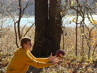
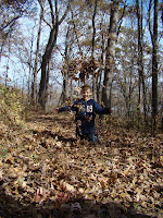
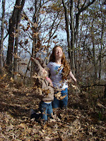
Nerstrand Big Woods State Park is nothing short of amazing.  Settlers to the area discovered it around 1854.  This park is loaded full of Sugar maples, aspen, elm, hickory, oak, basswood, ash, and more.  I couldn't help but think how beautiful the fall colors would have been a mere two weeks before I was there.  The canopy of leaves from this variety of trees would have been chock full of oranges, reds, purples, yellow, tans, and more!  For those that come here in the Spring and Summer, the park is well known for over 200 varieties of wildflowers, including the dwarf trout lily, which is a federally-listed endangered wildflower.  On my visit I went on a hike in the woods with my three oldest brothers, Brett, Brayden, and Brock.  We practiced the principles of "Leave No Trace" while we were there, and marvelled the whole time about the potential for fall colors.  We decided to come back next fall for a camping outing as the leaves change.....

Sakatah Lake State Park


Sakatah Lake State Park was formed by glacial activity over 14,000 years ago.  The glaciers left large mounds of rocks and mineral deposits called moraines in this region.  The park sits in one of those moraines and some parts of it in this park are over 400 feet deep!  Pretty cool!In "recent" times, the Dakota indians, specifically the Wahpekita tribe, inhabited the area that is now the park. It was this tribe that named the area Sakatah, which, in their language, translates roughly to "the sights and sounds of children playing on the hill," or "Singing Hills" The rivers in the region, Cannon River, Minnesota River, Zumbro River, etc, were the main transportation routes of the time.  Think of them as the "interstate highway system" of the day. Since the Big Woods area (the area of most of Central and Southern Minnesota) made land travel very difficult, water routes were optimal. There were lots of trading posts and Indian villages along these rivers. It is thought that an indian village existed right between Upper and Lower Sakatah Lakes.  In 1862, Alexander Faribault, a trader, set up a trading post on the shore of cannon Lake which became one of the first white villages in the region. 
The park is a beautiful system of trails around the lake that are perfect for hiking, biking, inline skating, and even cross-country skiing.  As you can see by my photos, my sister, Brielle, and I had a wonderful morning of hiking and exploring the trails around the lake.  You will have fun too, when you visit!

Saturday, October 30, 2010

Rice Lake State Park


My family at Rice Lake State Park from left to right:  Brayden, Brenna, me,
Brock, Brigham, Bralynne, Brynn, Brett holding Brooke, and Brielle

Rice Lake State Park
A little football by the Rice Lake!
Having fun in the playground
Rice Lake State Park geographically is the the headwaters of the south branch of the middle fork of the Zumbro River.  Whew!  That's a lot to get out!  Much like Forestville (Forestville/ Mystery Cave State Park) down the road, Rice Lake and the river had a dam to provide power for the mill down river in Wasioja.  Soon, the lake was depleted of water and the mill shut down.  North of town there was a Stage Coach route, too.  When the railroad came through the area by-passing Rice Lake, the little communities fate was sealed.  The only remains of the village today is the Rice Lake Church, which was built back in 1857.  Of course, the park is here to tell that story and among other things, the geology of this area.  That's a pretty neat story, too.  Most of this area was once on the bottom of a shallow sea covering most of North America.  On the sea bed, layers of sediment accumulated and when the sea dried, the layers turned to rock, hundreds of feet thick.  Its very similar rock to that found along the Mississippi River in the bluffs area.  During the time all this sediment was turning to rock, glaciers covered Minnesota four different times.  Most of the Rice Lake area was formed during the "Kansan Ice Age."  Pretty cool, huh?  For more cool stuff, check this park out!  Lots of great trails and scenary to enjoy!

Teaching Brynn about Rice Lake


Rice Lake overview
 

Brayden and I on the tire swing

Monday, October 25, 2010

Myre-Big Island State Park


Myre-Big Island State Park at dusk

Myre-Big Island State Park was is a nature lover's paradise.  The park is plumb full of raccoons, red fox, gray fox, squirrels, opossum, muskrats and deer.  Along the lake there are lots of turtles and frogs.  My hometown is well know for bird viewing, however,  the population and variation of species at Myre-Big Island is astonishing.  Speaking to a DNR employee, I found the common range of raptors-  Kestrel, Hawks, owls, etc., but even the great American Bald Eagle are here.  That's always a great sight to see!  Of course, in the summer one could relax on the shoreline and enjoy the sounds of the various songbirds-  a blue bird or oriole, and enjoy watching a wood duck or great blue heron frollick in the lake!  Geologically there is some pretty cool stuff here, too.  Much of this area was created by a receeding glacier, so careful searcing can find an esker on the north side of the park.  An esker is a ridge of sand and gravel that is created as a glacier rapidly retreats and leaves large blocks of ice that melt leaving their deposits in on area.  This park is great at dusk-  but be sure to bring a camera-  you never know what you will see!

Lake Louise State Park


Beautiful Lake Louise State Park

Its the Drevlow Family taking
 Lake Louise State Park
by storm

Ah, sand in my toes....

Lake Louise State Park is Minnesota's oldest, continuous recreation area. In 1853 the area was surveyed and the small town of LeRoy was platted.  The town needed power for a grist mill so the Upper Iowa River was dammed to provide hydro electric power. Shortly after, the railroad came through, but it passed south of the original townsite. Out of economic necessity, and knowing how devastating it would be for the local economy to not have access to the railroad,  the town of LeRoy was moved south to its present location. When the grist mill was abandoned, being off the rail lines, the family that owned the land along the mill's pond donated several acres to the town as a recreation area. At that time the site was named "Wildwood Park."  The mill's pond was named after a member of the donating party, the Hambrecht family, and still bears her name, "Louise." In 1962, the town of LeRoy donated Wildwood Park, which had now grown to about 70 acres, to the state of Minnesota to form the core of Lake Louise State Park. With the state's help, the park has grown to over 1,100 acres.  Although the park is used regularly by the locals for its swimming beach, it also has lots of great cross-country skiiing trails providing for fun year round!

Today I played a game of "hide and go seek"
with my younger brothers and sisters!


Imagine a beautiful sunny summer day
at the beach.  Memories are custom made
at Lake Louise State Park!


Forestville/ Mystery Cave State Park


The kids and I were very excited to explore this "ghost" town!

Forestville/ Mystery Cave State Park

This is the bridge on the outskirts of
Forestville.
Forestville/ Mystery Cave State Park interprets the story of Minnesota before the railroads and also shows the geology of a fascinating cave.  First, the town of Forestville;  it was founded in 1853 and became the rural trade center of the region.  Many other towns just like it sprang up all over the state.    It saw farmers from around the region bring their crops to town and of course, the area residents would be there to buy them and sell their wares.  It was a good mixture of buyers and sellers.  The town grew by leaps and bounds.  In only five years, 1853, the town had grown to 100 citizens and the town itself boasted of 20 buildings including two stores, a mill, brickyard, two hotels, school, and a few trades, such as blacksmithing.  In 1868, the first railroad to reach the region, the Southern Minnesota, decided to bypass Forestville.  The town's businesses started to lose their markets almost immediately, while new boom towns sprang up along the new Southern Minnesota lines.  By 1890, over half the town's residents had left, and most of those remaining worked on the farm of Thomas J. Meighan, whose parents had founded the town and one of the stores.  By 1910 the town ceased to exist.


The story of  Mystery Cave starts about 200 million years ago as sediment built up on the bottom of the shallow seas covering this region of Minnesota.  As the layers of sediment thickened, they compressed the bottom layers to form limestone, shale, and sandstone.  To get an idea of the dramatic change this region has seen, consider that we were once at the bottom of a shallow sea and now the region is some 1300 feet above sea level.    Today we call this the "karst region" of Minnesota because karst occurs where soluble rocks such as limestone are easily decayed by rainwater.  Evidence of this decay can be seen readily via sinkholes and caves, hence, Mystery Cave.  The cave has over 12 miles of passages making it the largest cave in Minnesota.  Take a day to visit this hidden gem of the State Parks and Trails system!  You'll be glad you did.

This is the original Meighan Store
in Forestville.


We earned a patch after visiting 8 state parks as members
of the "Passport Club" which is available at every state park!

Our family on main street, Forestville, MN


Saturday, October 23, 2010

Beaver Creek Valley State Park


Our family at Beaver Creek Valley State Park

Beaver Creek Valley State Park

Brielle asserting her tire
swing skills

Triple the sliding, triple the fun
at Beaver Valley Creek State Park!

Bralynne having fun at the playground

Beaver Creek Valley State Park is one of the hidden gems of the State Parks and Trails system.  It boasts a diverse array of wildlife, from deer, raccoon, muskrat, mink, badger, red and gray fox, to the occasional beaver, and wild turkey or even the timber rattlesnake!  These kind of diversity is possible because the park is situated in one of the most interesting geologic areas of Minnesota, the "driftless area." The "driftless area" is a 10,000 square mile patch of Minnesota, Wisconsin, Iowa, and Illinois, which was untouched by the most recent glaciers. But, when the glaciers left, torrents of their water poured into the rivers, carving deep harsh valleys. The rocky walls of Beaver Creek Valley are made up of a layer of sandstone sandwiched between two layers of dolomite, which were deposited by inland seas between 450 and 500 million years ago.  What's all that geological talk mean?  Basically, all the stuff that used to be here millions of years ago is still here, plus a lot of stuff from other areas of the midwest got dropped off here by the glaciers.  Presto!  Instant geological melting!  When we visited this park we spent a fair amount of time playing football in the picnic area while my youngest sisters played in the playground.  Then we hiked one of the trails and had a blast with the suspension bridge, which shimmied and shook with every step.  If you haven't found this gem of a park yet, its time to go....now! 

Watching trout off the suspension bridge


A cup cake treat in the picnic area


The suspension bridge holds our whole family-  can it hold yours?

Brenna playing "Swing!"


Great River Bluffs State Park


From left to right, Brock, me, Brynn, Brielle, Brigham, Bralynne,
Brenna, Brayden, Brooke, and Brett


Great River Bluffs State Park

Great River Bluffs State Park is classified as a "Natural State Park" and all attempts are made at preserving it to remain in exactly the condition it is in;  few, if any, changes.  Its panoramic views of the Mississippi River Valley are adorned with groves of oak and sugar maples so the view is worth the trip.  I found the trails up and down the ravines to be beautiful hikes with lots of color and wildlife including eagles.  The secluded picnic area made for a quiet afternoon lunch with my family and we have made plans to come back this winter to try out their sledding hill.  Word has it that the Drevlow family includes some world-class downhill sledders!

Brigham having fun with the leaves!

Brynn and I battling the
leaves.  There were so many of them!


John A. Latsch State Park

John A. Latsch State Park
 
Our family at John A. Latsch State Park

John A. Latsch State Park is located on bluffs about 500 feet above the Mississippi River.  The story goes that back in the mid 1800s when the area was being settled, steamboat captains would look for the three rocky-headed bluffs, named Faith, Hope, and Charity,  to navigate up and down the river.By the 1850s, a busy steamboat landing and logging town was sprung up below the bluffs. The logging activity supplied timber for the sawmills in the newly founded town of Winona. For years, this area could only visited by the few ambitious hikers who ventured up the steep and rugged hills for a bird's-eye view of the valley below. A local businessman, John A. Latsch, bought some of these blufflands and persuaded the adjacent landowner to donate, along with him, about 350 acres to the State of Minnesota for a park in 1in 1925 for a park. Latsch loved to fish in the waters below the bluffs of Faith, Hope, and Charity. Interestingly, he later donated land to the state of Wisconsin resulting in Perrot State Park, downriver from Winona in Wisconsin.
Preparing for the 1/2 mile hike up the bluff

Whitewater State Park


Our family at Whitewater State Park

Whitewater State Park
Whitewater State Park is nestled in South Eastern Minnesota's River Bluff country.  The Whitewater River was named by the Dakota Indians because it turned milky white in the spring as high water eroded light-colored clay deposits along its banks.  The Dakota Indians turned the area over to the US Government in 1851 in a treaty that would become a contentious part of Minnesota history, the Sioux Uprising.  As the settlers came to the area and built farms and cleared land, their land-clearing practices caused water run-off to gush into the valley and flood much of the area,  repeatedly.    Many of the small towns in the valley were devastated to the point of extinction.  I was told that in 1938 the town of Beaver, Minnesota flooded 28 times!  Area residents began to lobby the state to take over the area and reclaim its natural state creating Whitewater State Park and the 28,000 acre Whitewater Wildlife Management Area.  Now the natural beauty of the valley is preserved and the residents of the area a protected from danger.  
Enjoying a family photo on a rustic bridge over the
Whitewater River


My sister Brenna taking a
rest along the banks of
the Whitewater River
 
Seeing the landscape makes it
easy to understand the
potential for flooding


 The park is an outdoor enthusiast's playground, as it provides ample fishing opportunity, a great beach, lots of camping, amazing hiking trails, skiing, snowshoeing, and of course, name sake rafting.  Come check it out!